- DESCRIPTION
- SPECS
- IN THE BOX
- REVIEWS
9-inch Touchscreen Chartplotter
- 9-inch high-resolution intuitive touchscreen controls
- NMEA 2000® and NMEA 0183 support for network connectivity, including autopilots, digital switching, weather, FUSION-Link, VHF, AIS and more
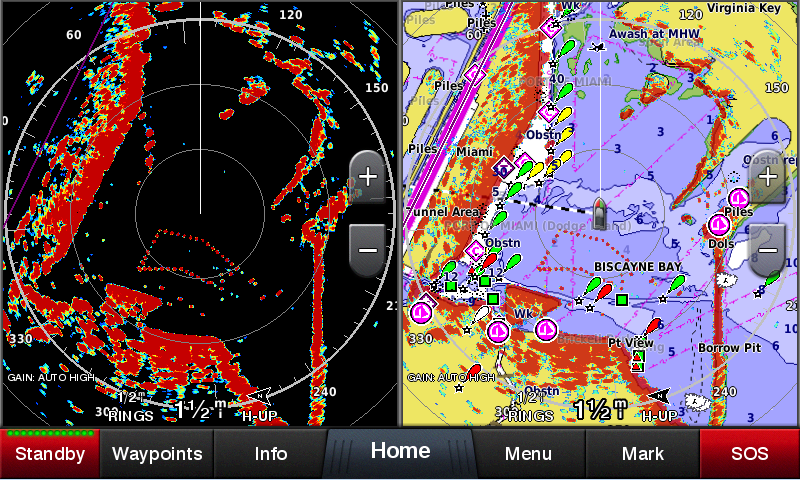
- Garmin Marine Network support for sharing sonar, including Panoptix™ sonar, maps, user data, radar and IP cameras among multiple units
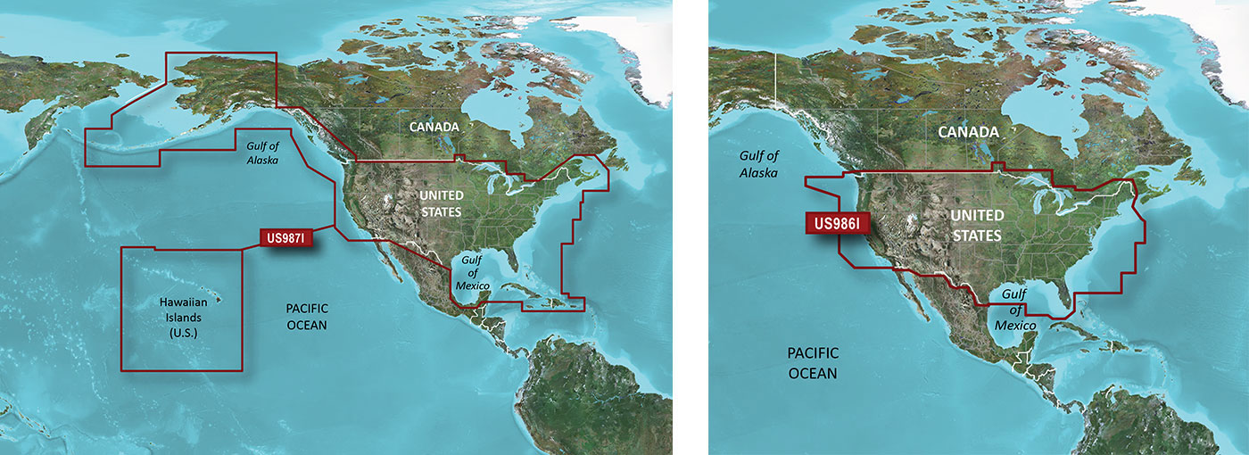
- Preloaded U.S. LakeVü HD maps and BlueChart® g2 HD charts
Experience an advanced navigation solution with this compact 9-inch GPSMAP 942 touchscreen chartplotter. Includes wireless connectivity features for Garmin mobile apps, NMEA 2000 support and Garmin Marine Network support for radar and Panoptix FrontVü collision avoidance sonar.
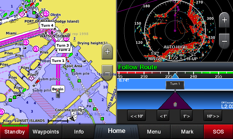
Garmin Marine Network and NMEA 2000 Support
Full-network compatibility allows you to add more capabilities to your boat. Garmin Marine Network support allows sharing of sonar, including Panoptix sonar, maps, user data, dome or open-array radar and IP cameras among multiple units. Plus, there’s NMEA 2000 network connectivity and NMEA 0183 support for autopilots, digital switching, weather, FUSION-Link, VHF, AIS and other sensors.
Built-in Wi-Fi® Connectivity
Enjoy built-in Wi-Fi connectivity for BlueChart Mobile 2.0 and Garmin Helm apps. Garmin Helm allows you to view and control your compatible chartplotter from a compatible smartphone or tablet while providing enhanced situational awareness for the mariner. With BlueChart Mobile, a free app downloaded from the App Store™, you can get reliable weather information while you plan marine routes on your iPad® or iPhone® then wirelessly transfer them to your boat’s compatible networked Garmin chartplotter. You can even stream and control a VIRB action camera from the chartplotter.
Built-in ANT® Connectivity
Enjoy built-in ANT wireless connectivity directly to quatix® marine watch, Garmin Nautix™ in-view display, gWind™ Wireless 2 transducer, GNX™ Wind marine instrument and wireless remote controls.
Heading and Position Refreshed 10 Times per Second
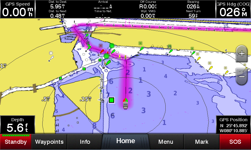
Fast, responsive built-in 10 Hz GPS and GLONASS receiver refreshes your position and heading 10 times each second to make your movement on the screen more fluid. It makes dropping up to 5,000 accurate waypoints — and finding your way back to them — quick and easy.
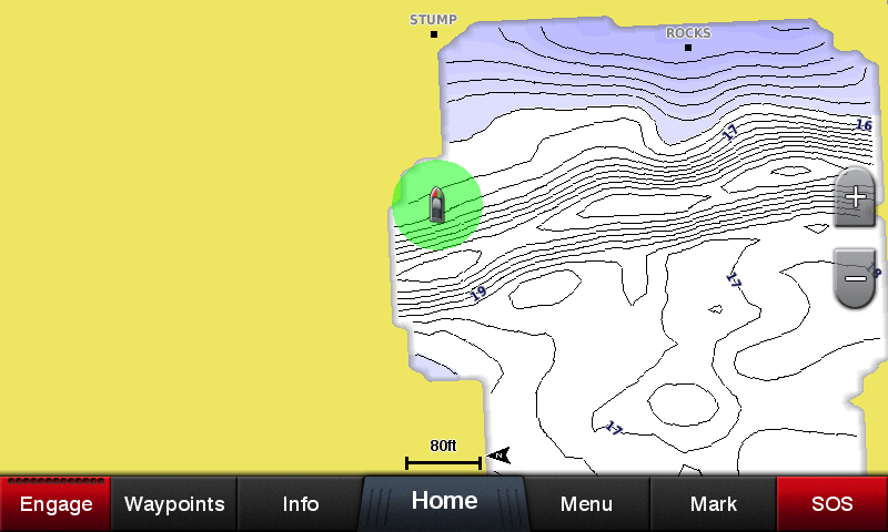
Preloaded with Exceptional Garmin Cartography
You get both LakeVü HD inland waters mapping and BlueChart g2 HD coastal charts.
LakeVü HD provides highly detailed freshwater maps that include 17,000+ U.S. lakes, rivers and reservoirs. Included in those are more than 13,000 HD lakes with 1-foot contours shoreline to shoreline. Upgrade to LakeVü HD Ultra with Max Def Lakes.
BlueChart g2 HD provides basic coastal charts, tidal stations, currents, depth contours, IALA symbols and includes fishing charts. It also transitions smoothly between zoom levels and delivers seamless continuity across chart boundaries.
Upgrade to Our Best Maps on the Water
Include expandable memory for accessory map purchases, such as LakeVü HD Ultra with Max Def Lakes or BlueChart® g2 Vision® HD that add Garmin patented Auto Guidance¹ and other great features.
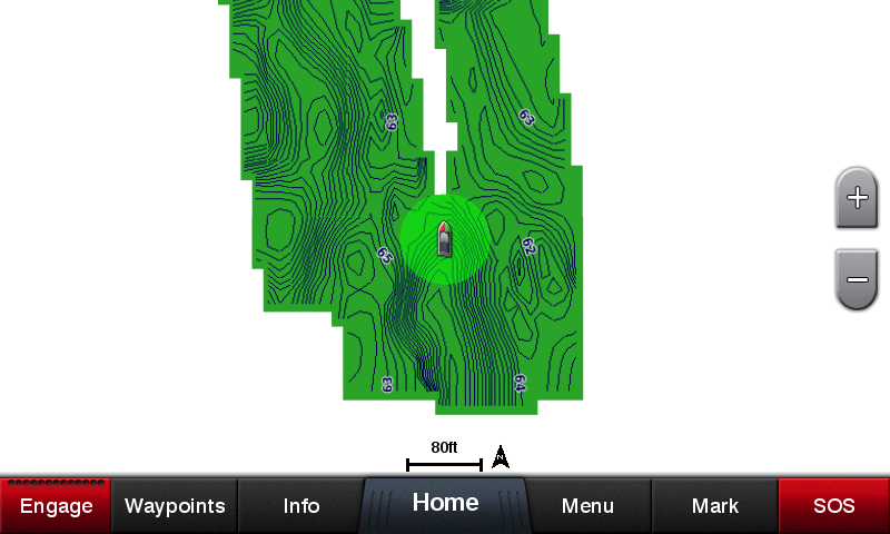
Quickdraw Contours to Create Your Own HD Maps
Instantly create personalized HD fishing maps on-screen with 1-foot contours. Tailor them to fit your needs. These are your maps — you own them. Keep the data to yourself, or share it with the Quickdraw Community on Garmin Connect™.
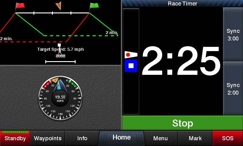
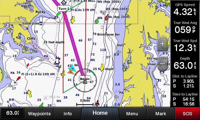
Built-in SailAssist Features
To help you gain a wind-maximizing competitive edge, your chartplotter features a pre-race guidance page that shows your virtual starting line along with data fields showing laylines, time to burn before the start and a race timer that can be synchronized across all your networked Garmin GPS products. In addition, other supported sailing features include an enhanced wind rose, heading and course-over-ground lines, set and drift, true and apparent wind data and more.
GPX Waypoints Transfer
If you have waypoints, tracks or frequently used routes stored on another manufacturer’s GPS product — or on a Garmin handheld device — it’s easy to transfer those items to your new Garmin chartplotter via industry-standard GPX software formatting.
1Auto Guidance is for planning purposes only and does not replace safe navigation operations.
iPhone and iPad are trademarks of Apple Inc., registered in the U.S. and other countries. App Store is a service mark of Apple Inc. Wi-Fi is a registered trademark of the Wi-Fi Alliance.


Physical & Performance
Display size, WxH 7.7" x 4.5" (19.6 x 11.4 cm) Display resolution, WxH 1024 x 600 pixels Physical dimensions 10.1" x 6.4" x 2.1" (25.6 x 16.2 x 5.2 cm) Receiver 10 Hz high-sensitivity Water rating IPX7 Weight 2.52 lbs
Mounting options Bail or flush Display type Multi-touch touchscreen WSVGA display Antenna Internal or external over NMEA 2000 Maps & Navigation
Routes 100 Track log 50,000 points; 50 saved tracks Preloaded maps BlueChart® g2 (coastal maps) and LakeVü HD (inland maps)
Accepts data cards 2 microSD™ cards Features
ClearVü Yes (with external black box, sold separately)
Waypoints 5,000 Wireless connectivity Yes NMEA 0183 compatible Yes SideVü Yes (with external black box, sold separately)
GCV™ Black Box sonar support Yes Wireless mouse compatible No NMEA 0183 input ports 1 (Differential)
Supports DSC (displays position data from DSC-capable VHF radio) Yes Additional - User interface: Multi-touch touchscreen
- Auto backlight dimming: Yes
- VIRB® compatible
- Wearables compatible through ANT
- gWind wireless compatible
NMEA 2000® compatible Yes BlueChart® Mobile (planning) compatible Yes Supports AIS (tracks target ships position) Yes Video output ports None Garmin Marine Network™ ports 1
Garmin Meteor™ Audio System compatible Yes Garmin Sonar compatible Yes (with external black box, sold separately)
GSD™ Black Box sonar support Yes Garmin SmartMode compatible (customizable monitor presets) Yes Wireless remote compatible Yes Garmin Helm compatible Yes Supports FUSION-Link™ compatible radios Yes NMEA 0183 output ports 1 (Differential)
Tide tables Yes SiriusXM™ Weather & Radio compatible Yes CHIRP sonar technology Yes (with external black box) Power consumption Max power usage at 10 Vdc: 27 W
Typical current draw at 12 Vdc: 1.3 A
Max current draw at 12 Vdc: 2.3 A
Voltage range 10-32 Vdc input GRID™ (Garmin Remote Input Device) compatible Yes Video input ports 1 BNC Garmin Radar compatible Yes - GPSMAP 942 chartplotter
- Power cable
- Bail mount kit with knobs
- Flush mount kit with gasket
- Protective cover
- Trim piece snap covers
- Documentation
SAFE & SECURE SHOPPING